
Ranches & Agriculture
Every acre documented — fence lines, water, and the ground under the brush
Based in Dripping Springs · serving Central Texas
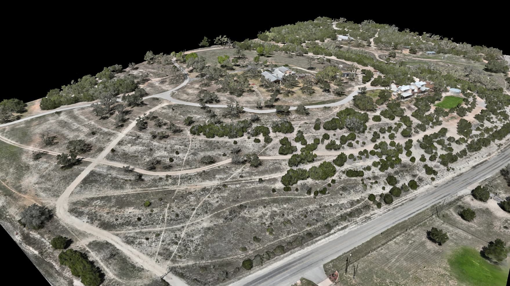
What we map for Ranches & Agriculture
Landowners and operators use our maps to get their arms around big properties they can't cover on foot — accurate acreage, fence lines, water features, and the real terrain hiding under the cedar. It's the Hill Country ground we know best, from Dripping Springs to the Pedernales, and one flight documents what would take days to walk. And where the drone can't reach — under the canopy, along the trails, up close to the structures — ground-level 360° walkthroughs let you revisit the property at eye height, navigable right on the map.
What ranches & agriculture teams are up against
Deliverables built for the job
One flight, the full set — measurable to about a centimeter, all in a browser link, nothing to install.
- Full-property aerial map and photoreal 3D model
- Accurate acreage and fence-line measurement
- Terrain under the tree cover for water and erosion planning
- Elevation map for ponds, drainage, and road placement
- Ground-level 360° walkthroughs of trails, water crossings, and structures, pinned to your map
- Printed Property Key — every gate, tank, blind, and crossing numbered on your own map, named in your words
- Offline Field Pack — your property on a phone with zero bars in the back pasture
- Plain-language change callouts between flights — “40 m northeast of the hay barn,” not a coordinate
- Optional 3D-printed relief of your property, sized to spec
Terrain & analysis layers
Extra layers we compute per-flight from your elevation data — no second trip to the site. Tell us which ones your project needs and we build them from your flight; ranches & agriculture teams use these to plan drainage, grading, and the ground under the cover.
Canopy height (CHM)
A canopy-height model computed per-flight from your elevation data — it separates the treetops from the dirt so you can see under the cedar to the real ground for water, erosion, and clearing decisions.
Drainage, flow, terrain, and floodplain layers are derived analysis computed from our elevation data to support planning and design. They are not a certified survey, a stamped engineering study, or a FEMA flood-zone determination.
The map is digital. The handoff doesn't have to be.
Not everyone who needs your map will open a viewer — the contractor at the gate, the guest past cell coverage, the appraiser with a folder. Every flight can also ship as pages and files built for them.
Included on request with any flight.
Name your places in the viewer, and tell us the routes you want carded — at the gate or by reply — and we'll draw and publish them for you.
A route on this page is a path recorded over this property from our own mapping — a line to walk or fly, and nothing more. It is not a road, an easement, or a right of way, and it is not a statement that the ground it crosses is maintained, legally accessible, or safe to travel on foot or by vehicle. Conditions on the ground govern: check them before relying on a route.
The service lines behind it
Ready to map your property?
Tell us about your site and goals and we'll put together a custom proposal with exactly what you need — no cookie-cutter packages.
Based in Dripping Springs · serving Central Texas