
Parks & Attractions
The whole park, mapped — every ride, path, and acre on one link
Based in Dripping Springs · serving Central Texas
What we map for Parks & Attractions
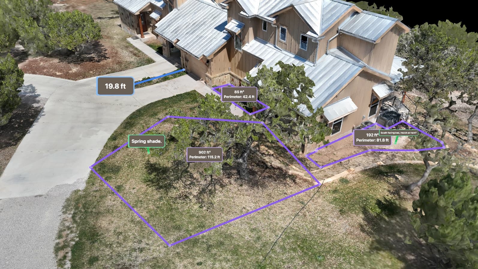
Theme and water parks, family-entertainment centers, campgrounds, and event grounds use our maps to document the whole property — the rides and structures, the midways and parking, the landscaping, and the open ground still left for expansion — measured to 2–5 cm horizontally — about a centimeter with the ground-control accuracy option. It's the master record operations, marketing, and planning teams work from without walking the park: a measurable aerial map, a photoreal 3D model, and ground-level 360° walkthroughs of the midway pinned right to the map. It all adds up to a virtual tour anyone can navigate from a browser.
What parks & attractions teams are up against
Deliverables built for the job
One flight, the full set — measurable to about a centimeter, all in a browser link, nothing to install.
- Full-park aerial map and photoreal 3D model, accurate to 2–5 cm horizontally — about a centimeter with the ground-control accuracy option
- Measured layout of rides, paths, parking, and structures you can annotate
- Elevation and terrain data for drainage, grading, and expansion planning
- Ground-level 360° walkthroughs of the midway and attractions, pinned to the map
- Printed Property Key of gates, service entrances, and back-of-house points — named in your words, for the office wall and the gate guard
- Offline Field Pack for maintenance and events crews working past the Wi-Fi
- Plain-language change callouts between flights, located by your own landmarks — not coordinates
- Shareable browser viewer for operations, marketing, and contractors — a link, nothing to install
- Repeat flights on a schedule — a dated record that tracks construction and changes flight to flight
Running a venue?
There's a hosted product built for exactly this
A living map of the whole property — in your brand, embedded on your own site, your words on every pin, re-flown on your schedule. The deliverables above are the pieces; Venue Maps is the product they add up to.
See the Venue Maps offerThe map is digital. The handoff doesn't have to be.
Not everyone who needs your map will open a viewer — the contractor at the gate, the guest past cell coverage, the appraiser with a folder. Every flight can also ship as pages and files built for them.
Included on request with any flight.
Name your places in the viewer, and tell us the routes you want carded — at the gate or by reply — and we'll draw and publish them for you.
A route on this page is a path recorded over this property from our own mapping — a line to walk or fly, and nothing more. It is not a road, an easement, or a right of way, and it is not a statement that the ground it crosses is maintained, legally accessible, or safe to travel on foot or by vehicle. Conditions on the ground govern: check them before relying on a route.
Ready to map your property?
Tell us about your site and goals and we'll put together a custom proposal with exactly what you need — no cookie-cutter packages.
Based in Dripping Springs · serving Central Texas